Pulaski Road Interactive Mapping Survey (2020)
Note: the Interactive Mapping Survey was active between July 27, 2020 and August 14, 2020. Thank you to all who participated!
Survey Overview
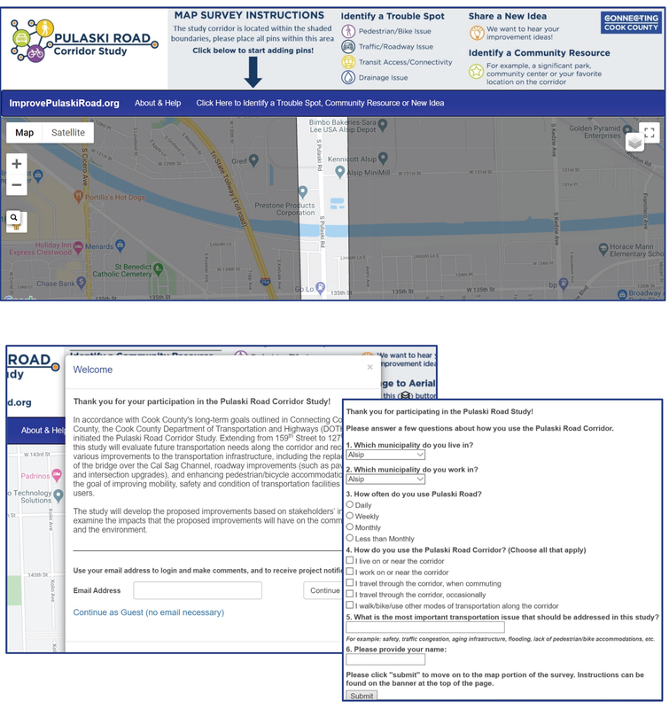
The Cook County Department of Transportation and Highways (CCDOTH) conducted a survey to gather information from the community to evaluate future transportation needs along the Pulaski Road Corridor including the replacement of the bridge over the Cal-Sag Channel, roadway improvements (such as pavement and intersection upgrades) and enhancing pedestrian/bicycle accommodations, with the goal of improving mobility, safety and the overall condition of the transportation facilities for all users. The survey aimed to enable the project team to 1) receive valuable community input from the beginning of the project and 2) reach more community members than typical in-person community outreach. The survey was accessible through an interactive webpage or could be provided via email and phone. The webpage contained a questionnaire and an interactive mapping survey. the survey was open from July 27th to August 14th.
Forty-Nine (49) community members participated in the survey.
|
Pulaski Road Interactive Mapping Survey Results
The intent of the Pulaski Road Interactive Mapping Survey was to gather community input on existing issues, key community resources and new ideas to improve Pulaski Road. The survey enabled participants to add pins and comments to specific areas along the corridor. The majority of pins added to the map highlight Traffic/Roadway Concerns along the corridor followed closely by Pedestrian/Bicycle Concerns. It is important to note that all categories of pins are valuable and provide insight into the corridor; however, those expressed on the map are deemed as the top priority items by survey participants. Comments provided on the survey were evaluated by the project team and will be integrated with technical analysis to develop corridor recommendations. |
The graphic below, displays the breakdown (percentage) of pins placed on the map by category.
|
Questionnaire Results
The questionnaire was presented as part of a welcome screen on the interactive mapping survey to gather information on how and why survey participants use the corridor and what they felt should be the top priority in improving the corridor. Of those participants who answered the Questionnaire, a majority of participants (91%) claim to live or work near the corridor and use the corridor regularly. Of those who live near the corridor, most participants (41%) claim to live in the Village of Midlothian but work outside of the study area. When asked about survey participant's top transportation priority for improving the corridor, 30% of respondents noted that Roadway Conditions should be the top priority when improving Pulaski Road. Look to the right for the distribution of all participant responses. |
Survey Next Steps
The information collected from this survey was used to recommend improvements to the Pulaski Road corridor transportation infrastructure.
During July 2020 and June 2021, the project team met with the Corridor Advisory Committee to discuss project updates and present corridor alternatives to the public during a Public Information Meeting. If you would like to be kept up to date on the project, please see our Contact Page.


